Douglas
Christine
Christopher - youngest of the group, son of Eddie and Christine
.
.
Danny - the only one who has been to this waterfall 10 years ago and we were counting on him to remember the trail. He was also our sweeper (and at times taking the lead especially when Steve took a wrong trail and had to u-turn)
Min Chee
Rachel
Nine of us met at the Blossom Food Court at 6.45am. MCTC and Eunice were late (which is hardly surprising) but we managed to get to Sg Buluh overhead bridge at the appointed time, which is 8am, to meet with the rest from KL.
It took us about an hour to reach the little town in Kuala Kubu Bharu, which looked like it had a facelift recently. Their roads are made of interlocking bricks and there were other developments going on nearby.
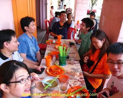
We had breakfast at this little corner restaurant, which was really packed. I had wan tan mee laksa while the rest had wan tan mee kon lou and pan mee. Eddie, who had the gift of interaction, won the proprietor's heart when he talked to her. She gave him a plate of fried wantan.


We drove for a further 10-15 minutes before we reached the parking area of Sg Chiling. From there, we walked about 100 meters to the main entrance, where we had a group picture taken.
 Say Cheese!
We had to walk for a further 5-7 minutes into this trail-like path before coming to an open space where the registration office is.

Registration was only 50 cents perperson. Cheap, yeah? The purpose of going through this process is to have a headcount on who went in. There had been incidences where people died while swimming in the falls because of the strong current that swept them away.

In this map, we have to cross 6 rivers to get to the waterfall. My thoughts :- it seemed weird that we must cross 6 rivers to get to the main waterfall when we could actually veer towards the right to bypass at least 5 crossings.

We cross the first river by walking on the suspension bridge provided. Only 4 people were allowed on this bridge at any one time.


The water level was about 1.5 - 2ft. We made it across without any mishaps.


After the 3rd crossing, I was right behind Eddie. I overtook him and went on ahead. I saw several people in front of me and assumed they were Steve, KingKeong and Douglas. They were moving very fast and I was trying to catch up with them. Then I heard Eddie calling my name. I thought it was because he couldn't see me and wanted me to slow down. I shouted back that I was only a little ahead of him. Several seconds later, he called me again and this time, I stopped so that he could catch up with me. My name was called a third time and I decided to see what was wrong. I backtracked and found that I had actually overshot the 4th corssing. Apparently, I was following the wrong group. (shy!!!!)
 It was a little steep after the 4th crossing.
At the 5th crossing, Christopher fell. It was totally unexpected as we were very careful when we cross any river. In fact, Steve and Danny were normally the ones who'd go first and help us cross the river.


We read in the Internet that the 6th crossing is the deepest and that it could reach up to waist level but it was only 2.5 ft in height. I guess it was because of the hot sun which we had for the past few weeks.
After the 6th crossing, we walked a little further before we arrived at the amazing waterfall. It sorta reminded me of the Yosemite falls (though I never got to see it because it was dry season but I do remember seeing pictures of it), the way the water cascades from a very high level.

There were about 20 other people enjoying the pool of water.

We dropped our backpacks and went into the water. It was so refreshing after hiking for 1.5 hours. The water felt as though it was refridgerated and we were immediately cooled off.

After about 7 minutes, some of the guys decided to go to the upper falls. From where we were, I looked up and knew it was going to be a steep climb. Waaay too steep and I wasn't sure if I was up to it.
I decided to go for it. I could always turn back if the climb was too tough for me.
 We had to cross the 6th river again to get onto the other side.
From there, we saw the trail, which was so steep - about 45 - 60 degrees. Gosh!! I wondered if I could make it. Earlier, someone told us that there was one part where it could be dangerous and if we were to slip and fall, we'd fall into the water. we'd probably die, too, as it was quite a distance down below. Gulp!
I was extra careful. Even though it was steep, the roots formed steps for us to climb on.
We arrived at the middle falls just after the "dangerous" part - where we had to climb on a big rock - but not to worry, those who are tall, would be able to climb easily. Not me! I needed someone to pull me up.

We could only take some pictures at the middle falls as there was no proper path leading to the pool of water. Moreover, the distance from the waters gushing down the middle falls to the lower falls is quite close and I wouldn't be surprised if one would be swept over to the lower falls if he were to attempt getting into the pool of water.

A narrow pathway but I am sure anyone can go through

Just before we reached the highest falls, there was a sudden drop and those with long legs would not have any problems - unlike yours truly.

We came to the higher falls after only about 5 minutes after the 2nd falls. There were a few people playing in the water. The area was a little too rocky to do any serious swimming.

We were able to look down right to the lower falls where our 6 other friends were.
I think we must've spent about 15-20 minutes enjoying the sound of the gushing waters and feeling on top of the world before it was time to get back to our friends.

We took about 10-15 minutes to descend. The others were still in the pool so we joined them. After having some fun, we had some sandwiches and rested for a bit.
We saw butterflies of various colours flying around. Made me think of the Butterfly Farm in Malacca and the lack of it there. I'm thinking that this place could also be called "Butterfly Sanctuary). Truly, there were so many beautiful butterflies fluttering around.


We left the area at 2pm and had to cross all those rivers to go back.

At crossings 2 & 3, we could've waded in the river to get from A to D (nstead of going from A to B, walk a little and then from C to D) , which some of us did, actually.

When we came to the little streams of water, we knew that we were going to reach the registration office soon.
The hike back only took us about an hour.
We had to tick off our names at the registration office to let them know that we are back, safe and sound.A few of us walked out to the car park to get our clothes. It was such a drag because we knew we had to get back into the registration office area to use the toilet facilities. It seemed like a total waste of time.
I had a little headache after I changed. RW called me to ask for directions to Bukit Panorama and while giving her the directions, my head felt heavy and I knew it was because of the sun. Sigh! Maybe it's a sign of me getting old!

The restaurant that we went to was famous for it's chicken chop. 8 out of 9 of us had that and we ordered extra mee hoon and fried rice. I was dehydrated and drank a glass of barley and one can of 100 plus - and I was still thirsty.
We left KKB at 5pm and arrived back at Seremban at 7pm. I was dead tired and slept throughout the journey back.
By the time I got back home, it was 7.30pm. I showered and got ready to go for cell.
Yeah, it was a tiring day but a fun one too :)

No comments:
Post a Comment